Bhadrapur (Bhadrapur)
Bhadrapur (भद्रपुर) is a town and municipality in Jhapa District in the Province No. 1 of southeastern Nepal. It lies on the banks of the Mechi River, and shares borders with Bihar state, India on the south and West Bengal state on the north. There is a border crossing with a customs office for goods. Galgalia village in Kishanganj district borders with Bhadrapur
Bhadrapur is one of Nepal's oldest municipalities. At the time of the 2011 Nepal census, it had a population of 18,164. Bhadrapur Airport has flights to Kathmandu. This airport is the best way to reach Kathmandu from the eastern part of Nepal and India (i.e., West Bengal, Sikkim).
Bhadrapur is one of the most multi-cultural cities in Nepal. In this city live people from all the districts from Nepal and who migrated from India, Bhutan, and Bangladesh. Different ethnic and religious backgrounds, such as Rajbanshi, Dhimal, Meche, Brahmin, Chhetri, Rai, Limbu, Sherpa, Tamang, Madbadi, Bengali, Muslim, etc., are living in Bhadrapur by maintaining a cordial relation, peace, and harmony among the people. Bhadrapur is the "tea city" of Nepal. It is a starting point for tourist attractions. A few hours' ride north takes one close to the Himalayas. There are good roads up to a height of around 3700 m.
Bhadrapur has important governmental and other important infrastructures, including a zonal hospital, airport, Mechi Multiple campuses, different schools, Mahendra park, stadium police and military headquarters, and hosts the Central District Offices.
However, due to the construction of the Mahendra Highway or East-West Highway (north of Bhadrapur), economic activities have shifted north to the junction of the highway Birtamod. This has left Bhadrapur with a receding population and crippled its once-booming economic activity.
In the last decade, Bhadrapur has slowly transformed itself into a tea hub with new plantations and tea factories being established every year. The much-awaited Mechi Bridge joining Bhadrapur to India (Galgalia) is constructed now and acts as a lifeline to the revitalization of Bhadrapur as well as the far eastern part of Nepal. There is a checkpoint at the border.
Bhadrapur was a very prosperous city during the early 1900s. It was renowned for its rice cultivation due to its rich fertile soil. This period saw rice mills being established. The prosperous rice business led Bhadrapur to its most prosperous period. Now, Bhadrapur has transformed into a major city of tea factories as the old rice mills are no longer operating.
Map - Bhadrapur (Bhadrapur)
Map


Country - Nepal
 |
 |
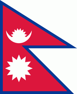
| Flag of Nepal | |
The name "Nepal" is first recorded in texts from the Vedic period of the Indian subcontinent, the era in ancient Nepal when Hinduism was founded, the predominant religion of the country. In the middle of the first millennium BC, Gautama Buddha, the founder of Buddhism, was born in Lumbini in southern Nepal. Parts of northern Nepal were intertwined with the culture of Tibet. The centrally located Kathmandu Valley is intertwined with the culture of Indo-Aryans, and was the seat of the prosperous Newar confederacy known as Nepal Mandala. The Himalayan branch of the ancient Silk Road was dominated by the valley's traders. The cosmopolitan region developed distinct traditional art and architecture. By the 18th century, the Gorkha Kingdom achieved the unification of Nepal. The Shah dynasty established the Kingdom of Nepal and later formed an alliance with the British Empire, under its Rana dynasty of premiers. The country was never colonised but served as a buffer state between Imperial China and British India. Parliamentary democracy was introduced in 1951 but was twice suspended by Nepalese monarchs, in 1960 and 2005. The Nepalese Civil War in the 1990s and early 2000s resulted in the establishment of a secular republic in 2008, ending the world's last Hindu monarchy.
Currency / Language
| ISO | Currency | Symbol | Significant figures |
|---|---|---|---|
| NPR | Nepalese rupee | ₨ | 2 |
| ISO | Language |
|---|---|
| EN | English language |
| NE | Nepali language |